Version History
Here you can find the changelog of Drone Pilot Canada since it was posted on our website on 2019-07-23.
The latest version is 3.3.1 and it was updated on soft112.com on 22 April, 2024.
See below the changes in each version:
version 3.3.1
posted on 2024-03-22
Bug fixes
version 3.3
posted on 2024-03-20
Checks for wind against drone's specification before new flight. Added a Sub250g drone pre-flight checklist.
version 3.2
posted on 2024-02-16
Bug fixes and updated Alberta Provincial Park information.
version 3.1
posted on 2023-09-14
Flight plans (created with this release or later) can be edited (if not yet assigned to a flight log) or "cloned" to create a new flight plan of similar characteristics. Once a flight plan has been assigned to a flight log, you can no longer edit, but you can add notes which will be appended to the flight plan document. Older flight plans created with earlier releases can also have notes appended.
version 3.0.1
posted on 2023-05-24
Minor bug fixes
version 3.0
posted on 2023-04-21
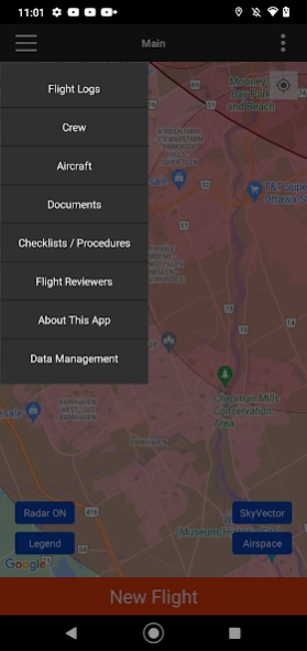
Updated to support French localization. You can now upload images, text files and PDF files directly from your device for Crew, Aircraft, Flights and Maintenance records, as well as general documents. You can also provide a custom link to an aircraft manual if your aircraft is not in the database.
version 2.9.1
posted on 2022-11-28
Fixed bug when trying to view RPAS Training Videos
version 2.8
posted on 2022-04-15
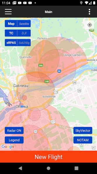
Two new features are the ability to assign Flight Plans to Flight Logs, and the display of NOTAM mapping details within NOTAM boundary circles. We have also swapped the NOTAM and Airspace Assessment function locations, so Airspace Assessments can be done directly via a map button. Display rotation is now improved and available on more devices, including phones. Also text fields now have first letters capitalized when entering text.
version 2.7
posted on 2021-07-26
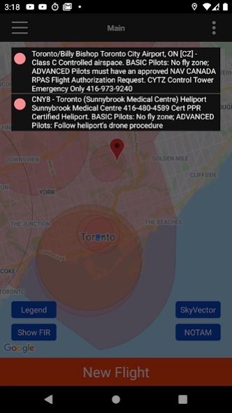
FIR NOTAMs (relevant ones) will appear on the map. Clicking on a NOTAM will display its details. NOTAMs will also appear in airspace assessments. The NOTAM button on the map, will show you a list of nearby aerodromes as well as the FIR to enable you to get NOTAM information for the respective entity.
version 2.6.4.1
posted on 2021-06-20
Minor bug fix.
version 2.6.4
posted on 2021-06-19
Improvements were made to the selection of NOTAMs to display for the Flight Information Region on Flight Plans.
version 2.5
posted on 2021-04-12
You can tailor the Emergency Button script for vertical/horizontal fly-aways. Edit the corresponding checklist item to suit your needs.
For safe drone flight, we have added the locations of major power transmission lines. You will see the lines as dashed red lines when zoomed in sufficiently. Power lines portrayed are high-voltage lines only, based upon available public data. You will receive a warning if a known power line is within one of your guidance circles when you begin a flight.
version 2.4.2
posted on 2021-02-25
Fixed issue with NAV Canada flight authorizations due to a change in their website.
version 2.3
posted on 2021-01-23
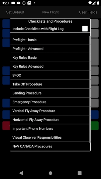
Add more flexibility in managing checklists.
1. Add your own checklists
2. Import checklists from a simple .txt file to replace user created checklists or the built-in checklists.
3. Selectively display checklists when creating a new flight
4. Update checklists stored with flight logs.
version 2.2.4
posted on 2020-10-25
Added two minor features.
1. If you rotate the map, a compass will appear and will rotate as you rotate the map. Clicking on this compass Icon will rotate the map so north is pointing up.
2. When showing the distance line, the bearing will be displayed along with the distance.
version 2.2.2
posted on 2020-10-09
1. One-touch airspace assessments
2. Checklist access during flights
3. Search by airport code or lat/long
4. Custom map location import
5. Yukon territorial maps
Also:
- Updates to the pre-flight checklists and VO responsibilities (if you have customized these, your lists will not be changed)
- Improved map following when your location is shifting (Android)
- Access to all types of documents from the 'Stored Documents' hamburger menu item
-updated checklists and procedures
version 2.2.1
posted on 2020-10-07
1. One-touch airspace assessments
2. Checklist access during flights
3. Search by airport code or lat/long
4. Custom map location import
5. Yukon territorial maps
Also:
- Updates to the pre-flight checklists and VO responsibilities (if you have customized these, your lists will not be changed)
- Improved map following when your location is shifting (Android)
- Access to all types of documents from the 'Stored Documents' hamburger menu item
version 2.1.1
posted on 2020-06-21
1. Added provincial parks (Nova Scotia parks fixed in 2.1.1)
2. Custom fields for Crew, Aircraft, Flights and Maintenance Records
3. Turn map following on/off
4. Detailed location information when tapping map marker
5. Export of Checklists
version 2.0
posted on 2020-04-16
1. Team Management - sharing information among devices
2. Saving checklists with flight lots (optional)
3. Distance measurement tool (long click on map)
4. Set custom radius for map circles
5. Recency fields for pilots
6. Recall previous search locations
7. UI improvements
version 1.7.1
posted on 2020-02-05
A pin will be placed at the location you select for a manual flight or flight authorization.
version 1.6
posted on 2019-10-10
Added:
1. Backup and Recovery
2. KP Index
3. Support for when your device does not have GPS.
4. A new Visual Observer checklist
5. New NOTAM link
version 1.5.3
posted on 2019-08-27
Bug fixes and minor improvements.
version 1.5.2
posted on 2019-08-13
Added the ability to load PDF files from other Android apps such as file explorers, file manager, etc, in addition to gmail.
Fix for this feature that was added in 1.5.1
version 1.4
posted on 2019-06-27
1. More flexible PDF document storage
2. Display of elevation on map when tapped
3. Access to VFR maps through SkyVector
4. Display of FIR (Flight Information Regions)
5. Rotation for Android tablets.